
Now this one was a puzzler, at least until a correspondent kindly provided an explanation. The Wheeling & Lake Erie, which entered Cleveland from the southeast, interchanged with the Erie at Literary Street Yard, out of view past the upper left of the slide. The train in this slide with Norfolk & Western units (the Nickel Plate absorbed the Wheeling in 1949 and was absorbed in turn by Norfolk & Western in 1964) is on trackage which leads to the former Erie Scranton Road freight house, where the track ends. So there were two questions here: where was this train going, and how did traffic get from the W&LE to the Nickel Plate (and vice versa)? Neither USGS topographic maps nor the excellent Cleveland map in July 2010 Trains provided any clues.
The explanation that I received (and I can't do better than quote it verbatim) is as follows: "The NKP/WLE and later NW ran 'Pullers' between the WLE's Campbell Road Yard and the NKP's East 55th Street yard. How? Via the Erie at Literary [Street Yard]. They would come off the WLE line, pull ahead, shove up to Literary, then run around and head to Erie's East 55th St. Yard then shove through West End and into the NKP track at their East 55th Street yard." (For an excellent map, see http://railsandtrails.com/NW/NW1964LoadsEmptiesRoute/NW1964TC-Cleveland-100u.jpg).
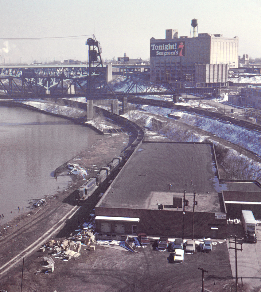
In any case, this view looking south from the Lorain Avenue bridge shows the Nickel Plate Road's viaduct and lift bridge across the Cuyahoga River, as well as the Erie's Riverbed Line (at far right) and connecting track to the Big Four (to the left of the Riverbed Line). The Interstate 90 bridge is in the background.
